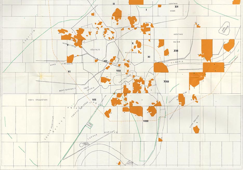
The 13 by 18 meter large Forma Urbis Romae shows on 150 marble panels the city plan from the time of Septimius Severus on a monumental scale of 1: 240.
It was located on the Foro della Pace in a side hall that had been used as a land registry
office

With its precise representation of the floor plan of all buildings, the Forma Urbis Severiana is not only the mother of all city maps, but also an outstanding urban development document that allows direct conclusions to be drawn about the structure of the ancient city. Its discovery in the 16th century is at the same time the starting point for many archaeological projects and the modern mapping of the city. To date, around 15-20% of the map area has been rediscovered in the form of
fragments
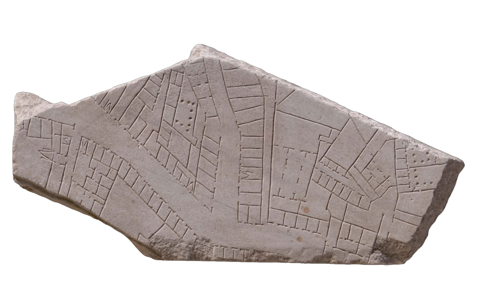
Through an intensive scientific examination of the Forma Urbis, researchers have succeeded in assigning a large part of the found fragments to their original
position
wall

Despite its urban and art-historical relevance, the Forma Urbis has never been shown in its entirety to this day.